


15.09.2026
Geographical Information Systems, commonly known as GIS, have long been used to produce maps for planning applications and technical reports. However, their value extends far beyond simply illustrating a site or proposal.
Thank you for getting in touch. We will be in contact shortly.
By bringing together multiple sources of spatial data, GIS can help identify development opportunities, understand constraints and test planning and transport scenarios before key decisions are made. This enables project teams to develop a clearer understanding of a site or wider area at an early stage, helping to reduce risk and inform more effective strategies.
This is becoming increasingly important as planning policy, evidence and decision-making become more spatial and data-led. Digital analysis can also help align land use, transport, infrastructure and development strategies, supporting a more coordinated approach to planning for sustainable growth.
GIS allows multiple planning, transport and environmental datasets to be considered together.
Green Belt and Grey Belt considerations, settlement boundaries, planning policy designations, flood risk, heritage, ecology, agricultural land, topography, land ownership and transport accessibility can all be analysed at an early stage.
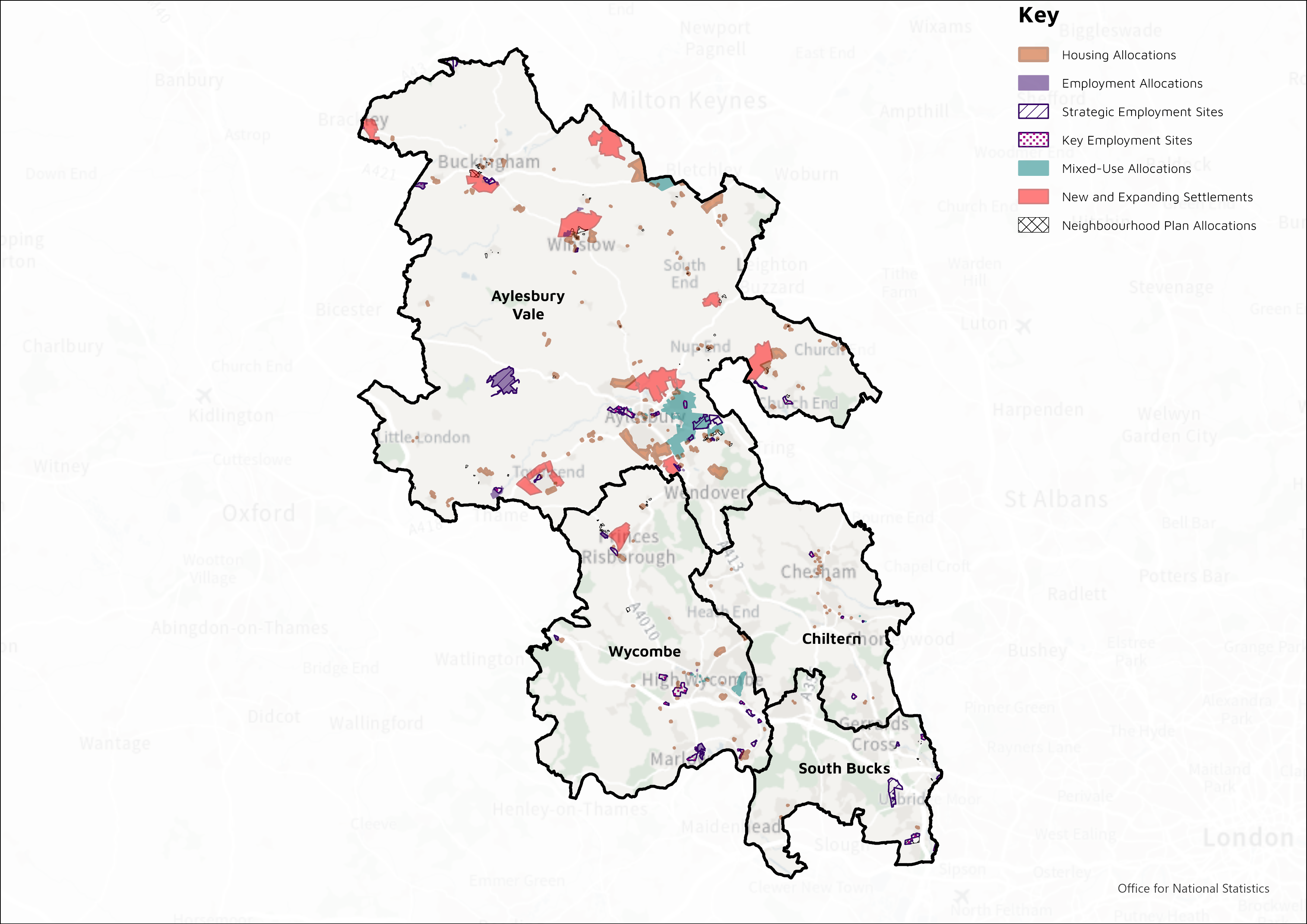
This analysis can support:
By identifying potential issues before substantial time and cost are committed, GIS can help focus attention and resources on the strongest development opportunities. It can also reveal spatial relationships and opportunities that may be overlooked when datasets are considered separately.
GIS can help demonstrate how a site relates to its surrounding area, including access to schools, shops, employment, healthcare, public transport and community facilities.
Walking, cycling and driving-time analysis can support assessments of a site’s accessibility and sustainability. Transport isochrones can clearly illustrate the destinations that can be reached within defined journey times, while more detailed route analysis can identify barriers and opportunities for improved walking and cycling connections.
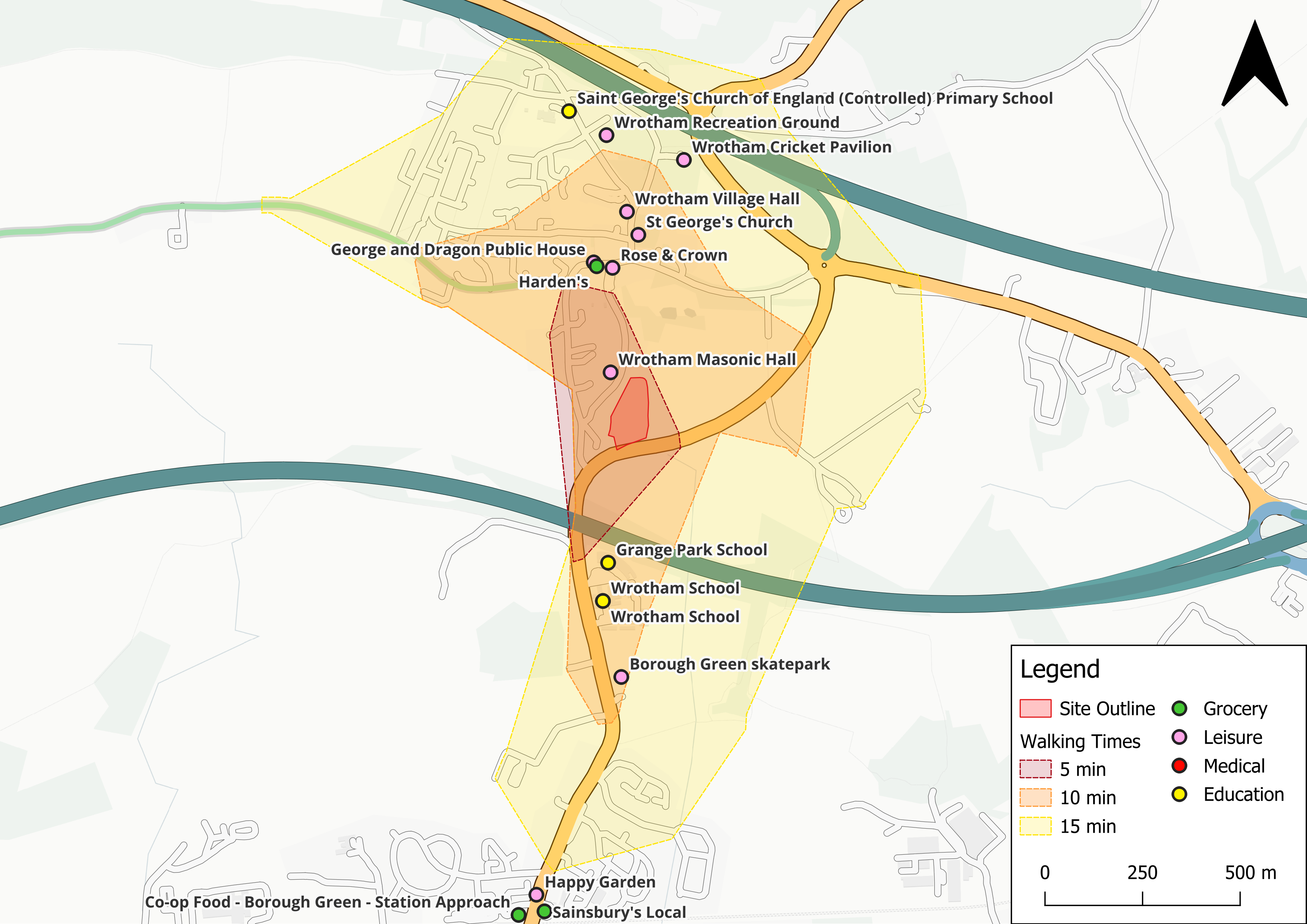
This evidence can be especially valuable when assessing potential development locations, preparing transport strategies or explaining the sustainability credentials of a proposal.
Topography and landform can significantly influence the feasibility, layout and environmental effects of development.
LiDAR and other topographical data can be analysed through GIS to provide a detailed understanding of site levels and surrounding terrain. This can support initial site assessment and design development by identifying changes in elevation, physical constraints and relationships with the wider landscape.
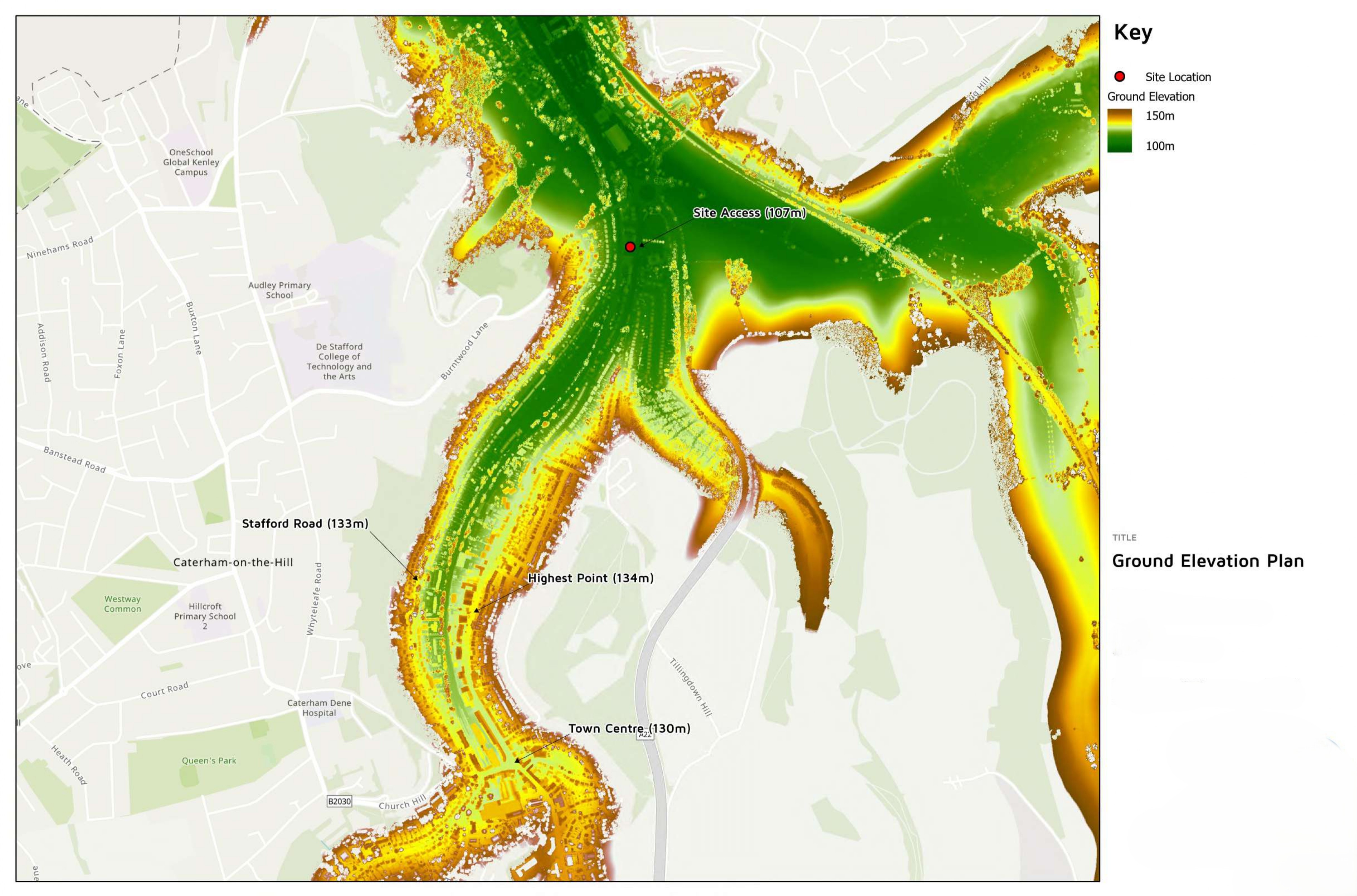
GIS can also combine land ownership, environmental receptors and surrounding development proposals to support cumulative-impact analysis and provide a more complete picture of the factors affecting a site.
The value of GIS is not limited to technical analysis. Clear, legible and well-designed visual outputs can make complex evidence easier for planning officers, councillors, consultees and local communities to understand.
An effective map can demonstrate not only where a site is located, but also why its location matters. It can explain how a proposal relates to planning policy, environmental constraints, transport networks, local facilities and surrounding development.
This can help create clearer and more persuasive evidence for planning applications, appeals, Local Plan representations and public consultation.
DHA uses GIS across its Planning, Transport and Environmental teams to support evidence-based advice and better-informed decision-making.
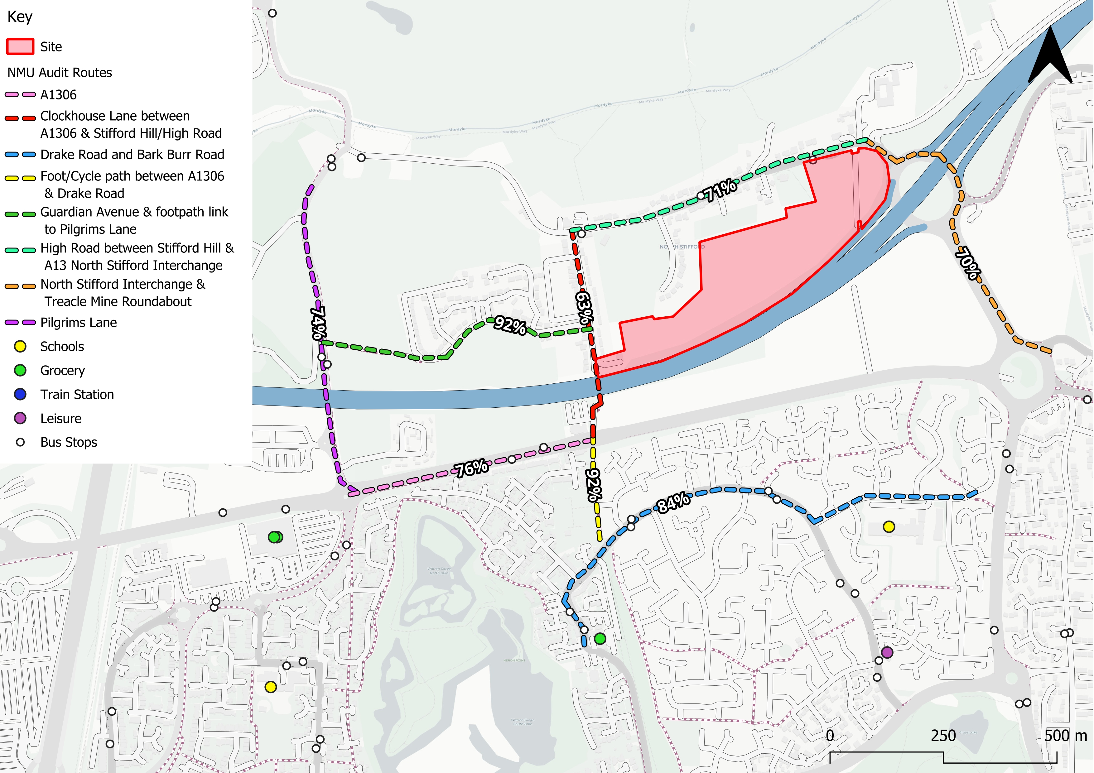
Our GIS capabilities include:
By bringing together expertise from across DHA’s disciplines, the analysis can be tailored to the particular requirements of a site, land portfolio, Local Plan promotion, planning application or transport strategy.
GIS is no longer simply a way of illustrating a planning case at the end of the process.
Used from the outset, it can help identify stronger sites, uncover opportunities, understand constraints and shape better planning and transport strategies. It can also turn complex datasets into clear and persuasive evidence, helping clients and decision-makers understand the spatial relationships that underpin a proposal.
As planning becomes increasingly data-led, GIS will play an important role in supporting informed decisions and unlocking development potential with greater confidence.
To discuss how DHA’s GIS capabilities could support a site, portfolio, Local Plan promotion or transport strategy, please contact Carleigh Westwell.
Thank you for getting in touch. We will be in contact shortly.


